Coordinates: 8°20′31.2″S 115°30′28.8″E / 8.342°S 115.508°E / -8.342; 115.508
Goto Mount Agung Map
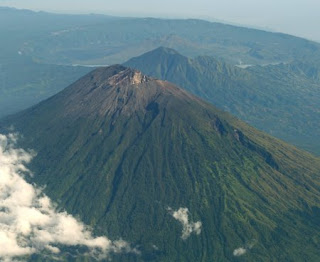
Mount Agung is the highest mountain on the island of Bali. The mountain is located in the district of Rendang, Karangasem regency and Bali province (Indonesia). It was about 58.59 kilometers (36.41 miles) from Ngurah Rai airport.
This mountain had erupted in 1963. As a result of the eruption, the height of the mountain which was originally 3.142 meters, reduced to 2.920 - 3.014 meters (approximately). It is the highest point at the Bali island and is classified as stratovolcano.
Mount Agung is sacred by the local peoples. The Balinese believe that Mount Agung is a replica of Mount Meru, a mythical place that supposed as the central axis of the universe. A legend holds that it mountain is a fragment of Mount Meru that was brought to Bali by the first Hindus. Bali's most sacred temple, Besakih actually sits on its slope.
The adventurous traveler can attempt to climb the volcano between July and October. For beginner and intermediate climbers, they must be sure to hire a guide, as the route is long, difficult and dangerous.
There are three routes up the mountain, ie:
- From the southeast through the village of Nangka can be reached from after the village of Budakeling. In Budakeling that is office for aide supervision of Mount Agung and can be reached by vehicles from Karangasem.
- From Besakih which proceeds to a higher peak and starts at approximately 1,100 m (3,610 ft), it's the common and easiest route used by climbers. Through this path, you would be treated with memorable view of Mount Agung from along the journey. You will also witness the local people who did worship regularly on Pura Besakih.
- The other one which commences higher is from Pura Pasar Agung, on the southern slope of the mountain, near Selat village (Pasar Agung) and which is reputed to take four hours. Typically the climbers stay overnight at Sangkan Kuasa.
Guides are available in Besakih and for the experienced climbers, the mountain can also be climbed without a guide. Although the pass way over Besakih temple is the easiest, it still quite tough. It is sometimes tackled as a single climb generally starting about 10.00pm for a dawn arrival at the peak and sometimes with an overnight camp about three quarters of the way up. It is far harder than the more popular Balinese climb up Gunung Batur. It is not a mountain that needs ropes and not quite high enough for altitude sickness (especially for professional climbers) but adverse weather conditions develop quickly and warm waterproof clothing is required and should be carried. Also, there is no water available along the route.
As a place that is considered sacred by the Hindus on Bali, the following are Things to Look For In Climbing Mount Agung
- In Bali, it is very strong traditional element in the spiritual life of religion. No attempt was made to climbs when there is any religious ceremony activity on Pura Besakih Temple or Pasar Agung. It is possible to maintain the sanctity of Mount Agung and Besakih or Pasar Agung that is be placed lower than the ascent.
- Weather should be a top priority in climbing safety. When it's rainy season or seasons that are not allowed to climb, better be undone to keep things that are not desired. Climbing fields consists of stones that would be more slippery than usual.
- For women who are menstruating, obligated to not climb. Remember that the Balinese very respect and uphold the sanctity of the Mount Agung and the surrounding area. We know about the myth that women who are menstruating are considered more dirty and of course if enforced to climb would result in less good for a climber. (Please do not believe this).
- It is recommended to not to bring food or drink that comes from beef. Cows are considered to be sacred animals by the Hindus.
- There is a myth to climb together in the number of evens.
View Larger Map
** indonesian mountain **


0 comments:
Post a Comment